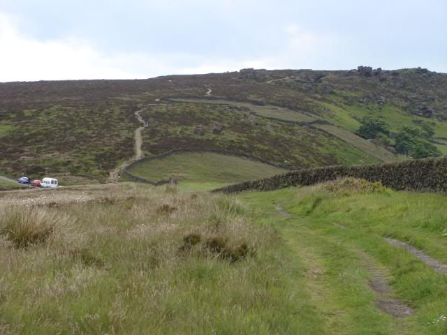
The Satmap is a recent acquisition and I thought I would write a review based on my initial thoughts and experiences with the device. I've only had the unit for about a week and has so far has only been used once in anger!! This review isn't going to go into great detail about how to plan routes and the pros and cons that different settings have on the device - this has been done to death and all that information is in the user manual which is available as a free download from the Satmap site. What I will endeavor to do is give a real world users eye view of the Satmap.
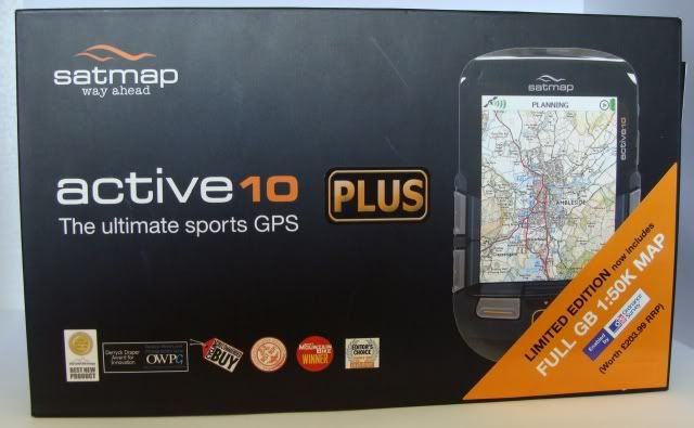
I bought the Active 10 Plus bundle from Outdoor World which included the rechargeable LiPo (Lithium Polymer) battery and a full GB 1:50k OS map card. The unit was on offer at £315.99.

So what do you get for your money? The unit is well presented in a nice quality cardboard box with a drawer at either end that concertinas outwards. In one drawer was the unit itself and in the other the map card, case, lanyard, LiPo battery, usb lead, various travel adapters including a uk 3 pin plug, car charger adapter and a set of three Energizer AA lithium batteries. The second drawer has a further section containing things like warranty cards, a voucher giving access to the online route planner and route share system, a money off voucher for custom mapping and a quick start guide. It comes pre installed with a 1:3,000,000 world base map, a 1:1,000,000 UK, a 1:250,000 large scale road map and a vector base street map which show minor roads, waterways, railways etc. albeit without labels and names. Only major roads are identified. As already mentioned my unit came bundled with a full GB 1:50k Ordnance Survey map on SD card. If you don't get this bundle then maps need to be purchased separately which adds considerable cost to the device. Further maps are available in both 1:50k and 1:25k scales and can run anything from £35 for a small county to £104 for national parks in 1:25k scale. The full 1:50k GB map is around £200!!!
The unit comes with the battery caddy installed in the back designed to take three AA cells. As the optional LiPo battery came with my unit I removed this. The caddy fits extremely tightly into the back of the unit and takes some considerable force to remove. I did this using a flat head screwdriver under a tab located on the top left of the caddy - according to Satmap the caddy is designed to 'warp' and will not break under the force of removal. The back of the unit is removed by rotating the little metal D ring on the back case which releases the back. The battery compartment is well sealed with a gasket running around the compartment to prevent water ingress.

This brings me to the first of my minor design niggles. Both the AA caddy and the LiPo battery connect to the unit via wires and a mini plug arrangement. When the plug is seated in the socket of the unit it sits flush so the only way to get it out is to grip the very thin wires and pull. It has to be said that whilst the wires are thin they seem fairly sturdy but even so I can see this being a point of failure if you change batteries regularly - in fact Satmap recommend that the battery is removed when it's not in use. I chose to ignore this advice rather than risk premature failure of the battery connections. Add to this the faff of changing the battery on the trail in the rain and it soon becomes apparent that a modular battery pack similar to that of mobile phones and cameras would be by far the best way forward. Battery life is a question that is often asked. In short there really is no answer to this question. Battery life is affected by a myriad of different circumstances and user definable settings from how long the screen is lit, screen brightness, how often the unit receives a satellite signal, power saving settings and on and on and on. Expect anywhere between 7 and 30+ hours from the LiPo battery.
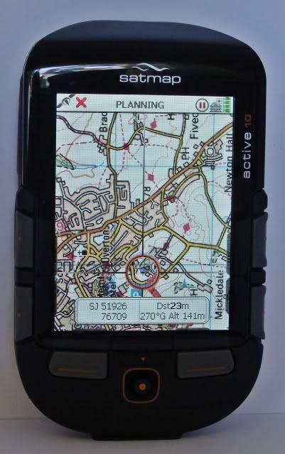
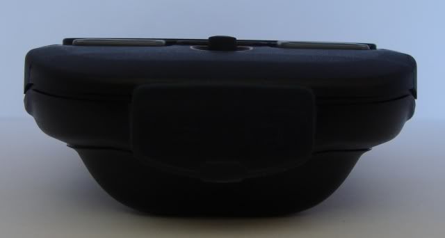
The unit itself is constructed from tough ABS plastic which sits well in the hand. The screen has a removable polycarbonate cover for protection and spare covers are available should it become damaged or scratched. This, in my opinion, is a revelation. Spare screen covers are around £7 each to buy and should increase the longevity of the device greatly - no need to worry about breaking or scratching the screen.
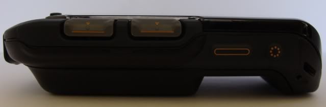
On the front of the unit you get a 3.5" colour LCD TFT screen with a resolution of 320 x 240. There are six buttons and a mini joystick. All the buttons on the Satmap sport a rubber cover for weather proofing and this does mean that you have to give them a good solid press for the button to function. On the right hand side there are two smaller rubber covered buttons a power switch and a back light boost switch. At the bottom of the unit is a mini usb port for charging and pc connection and on the left hand side is the SD card slot. Both of these slots have rubber covers as you would expect and are permanently attached along one edge to prevent loss. There isn't a touch screen in site which is a bonus. Anyone that has ever tried to operate a touch screen device with cold hands or wearing gloves will know how difficult a task this can be. Touch screens require a precision that is difficult to muster with freezing cold, wet hands and I much prefer having good sized buttons to do the job.


The unit feels tough and durable and promotes a sense of assurance that it can withstand the rigors of outdoor use. It does have to be mentioned however that it is NOT waterproof. Satmap say that the unit is weatherproof and snow and rain will have no adverse effect on the unit. From the many reviews I've read myself this seems to be the case although it is possible for water to find it's way between the screen and the polycarbonate screen protector although this is an annoyance rather than a problem. A heavy duty rubberised cover is available as a £40 optional extra for 'Extreme weather conditions'. Satmap don't state what they class as extreme but I've heard of very few problems with water ingress unless the unit has been submerged. The screen protector has to be removed to fit the heavy duty cover which results in more faff. I don't have long nails and as such the screen protector is difficult to remove and would be a job for Amanda!! As I've read many accounts of the unit being used on a motorcycle in the rain without the optional cover I don't think it's an investment that I will be making any time soon.
In use I find the unit extremely easy and intuitive in it's operation. On board route planning is a breeze and very user friendly. You won't find bank upon bank of stacked menus requiring several dozen key presses to perform a simple task here. Route planning can be done via the map or inputted grid references. Route planning via the pc is even easier using Satmps own online Route planner which gives you access to os maps in both 1:50k and 1:25k scales. There is also a route share facility incorporated too. Unless you buy a bundle with the route share voucher included access to these facilities will cost a one off payment of £79.99. Once your route has been plotted you can download this to the pc and upload to the Satmap unit via the free SATSYNC software.
It's worth mentioning that the route share voucher and the terms and conditions on sign up state that access runs for 12 months form the date of sign up. This isn't true - route share access is automatically renewed every year at no further cost. According to Satmap 12 months is stated for legal reasons due to ongoing licensing renewals with Ordnance Survey. It would be illegal for them to advertise lifetime access unless they had a lifetime license with OS which they do not they have to renew their licensing agreement with them every year. I will write a review of the online route planner separately.
The unit uses the ever popular SirFStarIII chip-set although it can take several minutes to find a lock from a cold start. Once it's found a lock though it keeps it and I had no problems with signal loss or dropping under thick tree canopies. Warm start is very quick often producing a lock within seconds.
On the trail the unit performs flawlessly. Following a pre planned route is simplicity itslef and the unit can be set to record and store a myriad of information as you walk. The unit has a proper magnetic compass in addition to the gps compass and switches automatically between the two depending on whether you are moving or standing still. You can configure the unit to switch between the two at user designated speeds i.e. above or below x miles or kilometers per hour. The compass can also be set to read Grid, Magnetic or True North. The screen is easy to read even in direct sunlight although there is a setting for a sunlight filter and a red filter for night time use should you need it.
On the main map screen you can configure either two or four text boxes to overlay the screen containing user configurable information from a vast list of options like trip distance, grid reference, way point information and so on. These are displayed via a button press then disappear after a few seconds so as not to interfere with the map view. The device is also capable of displaying POI information in the form of photographs and text.


So is this the perfect outdoor GPS device? Well no it's not but then again nor are any others. I did a vast amount of reading and tired quite a few of the popular devices before deciding on the Satmap. Whilst it has it's faults most of it's niggles are just that - a minor annoyance rather than a full blown problem. The longevity of the battery connections remains to be seen and I'd be lying if I said that it's weatherproofness wasn't a bit of a concern but these will be tested in the fullness of time. I knew what I was getting before I bought the unit and I am more than happy with my purchase.
There are many pros with this device and, as yet, no major cons - minor niggles yes - cons not really. It's still early days in my ownership of the Satmap and as time goes by I will add to or possibly re-write this review as I become more acquainted with the unit.
Technical Specification
| CPU: | ARM 9 |
| Screen: | 3.5" LCD TFT |
| Built-In Memory: | 128MB RAM |
| SD Card Reader: | Expandable up to 4GB |
| Memory Card: | SD Slot, no memory card supplied |
| GPS Receiver: | Integrated SiRFStarIII Receiver |
| Compass: | Built-in 2 Axis electronic compass |
| Sound: | High Quality Speaker |
| Power Supply : | 3 x AA Alkaline batteries 3.7v 2700mAh lithium Polymer 'smart' battery 240v/120v mains supply 12v DC vehicle cigarette lighter |
| Weight: | 250g (inc 3 x AA's) |
| PC Connection: | Via mini-USB cable (supplied) |