DISTANCE: 4.9 Miles
MAP: OS Explorer 267 Northwich and Delamere Forest
ELEVATION PROFILE


This was our second walk a Frodsham circular taking in part of the Delamere Way and Sandstone Trail. The forecast was for rain but arriving at the Beacons car park in Frodsham it was quite warm and sunny. The wind was starting to pick up but to be honest we didn't mind as the wind was cooling - it's never a nice experience walking when it's too warm!!
Turning left out of the car park onto Simons Lane we walked down the lane a few hundred metres then turned left onto the track at Overhill Cottage which leads through the grounds of the Heathercliffe Hotel and onto the Delamere Way before coming out again onto Manley Road. A short walk up Manley Road led us to the gates of War Memorial Field which, you guessed it, leads to the War Memorial and joins the Sandstone Trail.
 |
| Looking out from the War Memorial at Overton Hill towards the Mersey Esturary |
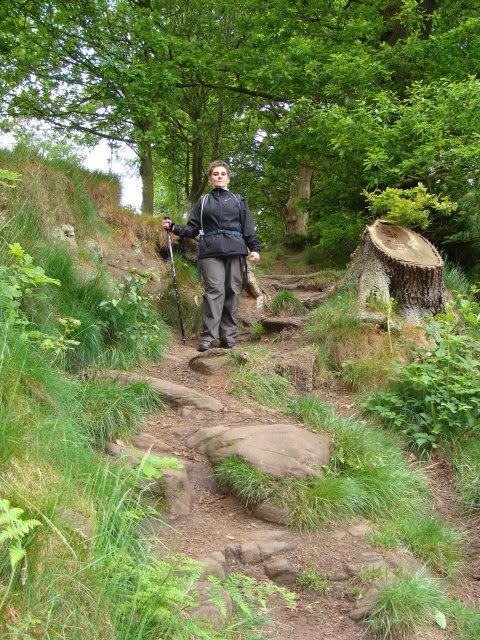
The trail meanders through woodland with rocky outcrops following the edge of the steep sandstone cliffs. A lot of the sandstone bears the names of workers past intricately chiseled into it - a sort of old school graffiti if you will. Although quite enclosed with the canopy of trees you occasionally come to a clearing with good views of the surrounding landscape and when those views aren't available there are plenty of weird and wonderfully shaped trees to admire.

In time the track leads to a waymarked junction. We turned right and continued along the trail signposted Delamere Forest and down the steps known as Bakers Dozen into Dunsdale Hollow. The steps were created to provide a safer alternative to Jacob's Ladder the original route down into the hollow.
 |
| Jacob's Ladder |
From Dunsdale Hollow a short hill leads to steps cut into the sandstone which double back on themselves and lead on to the continuation of the trail.
 |
| The Rock Steps |
At the next junction is another clearing and a thoughtfully placed bench for those who may wish to rest and take in the view. Turning left up the hill adjacent leads to another junction that took us into Snidley Moor Wood home to the woods oldest tree a Silver Birch said to be over 100 years old. Inside the tree is a notebook and pens for visitors to write comments some of which are posted on their website.


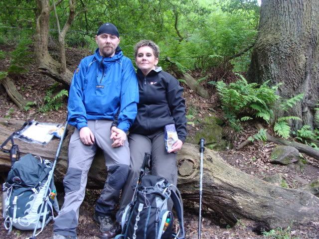
A few hundred yards further down we turned left off the trail, through a kissing gate, onto a track verging farmland for the return leg of our walk (Grid Ref: SJ51083 74831). The path leads into a small wooded area where we found a suitably sized log to sit and have lunch.
After lunch we continued along the short path and through a kissing gate leading to a very steep climb into fields. The field led to another kissing gate and we crossed Riley Bank and followed the road around to the left and left again onto the first of two successive restricted byways both of which were sandy tracks. The second byway led back onto Manley road and a short distance up the road another kissing gate and field which was the last leg of our trip (Grid Ref: SJ51970 75542).

Crossing a farm track at the far end of the field and walking through the golf course - watching for stray golf balls of course!! - brought us back onto Simons lane and a short walk back to the car park. It started to rain just as we got back to the car park - perfect timing!!
The Sandstone Trail is extremely easy to navigate with excellent way marking along the way and at every turn and junction. There are some steep, in excess of 1:10, inclines to test the legs along the way although these are minimal and overall this is an easy circular walk.


Thanks for mapping this - it's almost exactly the same route as one of my runs, and I've never measured it :)
ReplyDeleteNo problem Steve. It's a nice area
ReplyDelete